Page 16 - Folk Mapping: Cape Breton Examples
Published by Ronald Caplan on 1987/1/1 (693 reads)

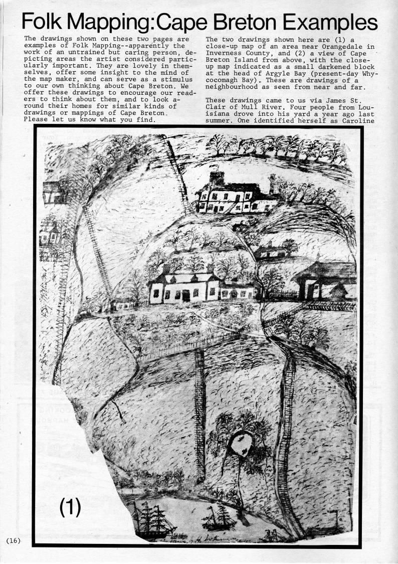
Folk Mapping.Cape Breton Examples The drawings shown on these two pages are examples of Folk Mapping--apparently the work of an untrained but caring person, de? picting areas the artist considered partic? ularly important. They are lovely in them? selves, offer some insight to the mind of the map maker, and can serve as a stimulus to our own thinking about Cape Breton, We offer these drawings to encourage our read? ers to think about them, and to look a- round their homes for similar kinds of drawings or mappings of Cape Breton,, Please let us know what you find. The two drawings shown here are (1) a close-up map of an area near Orangedale in Inverness County, and (2) a view of Cape Breton Island from above, with the close- up map indicated as a small darkened block at the head of Argyle Bay (present-day Why? cocomagh Bay) .. These are drawings of a neighbourhood as seen from near and far. These drawings came to us via James St. Clair of Mull River. Four people from Lou? isiana drove into his yard a year ago last summer. One identified herself as Caroline


Adobe Acrobat Reader is required to the PDF version of this content. Click here to download and install the Acrobat plugin