Page 33 - A Geology Walk up the Clyburn Valley
Published by Ronald Caplan on 1994/8/1 (227 reads)

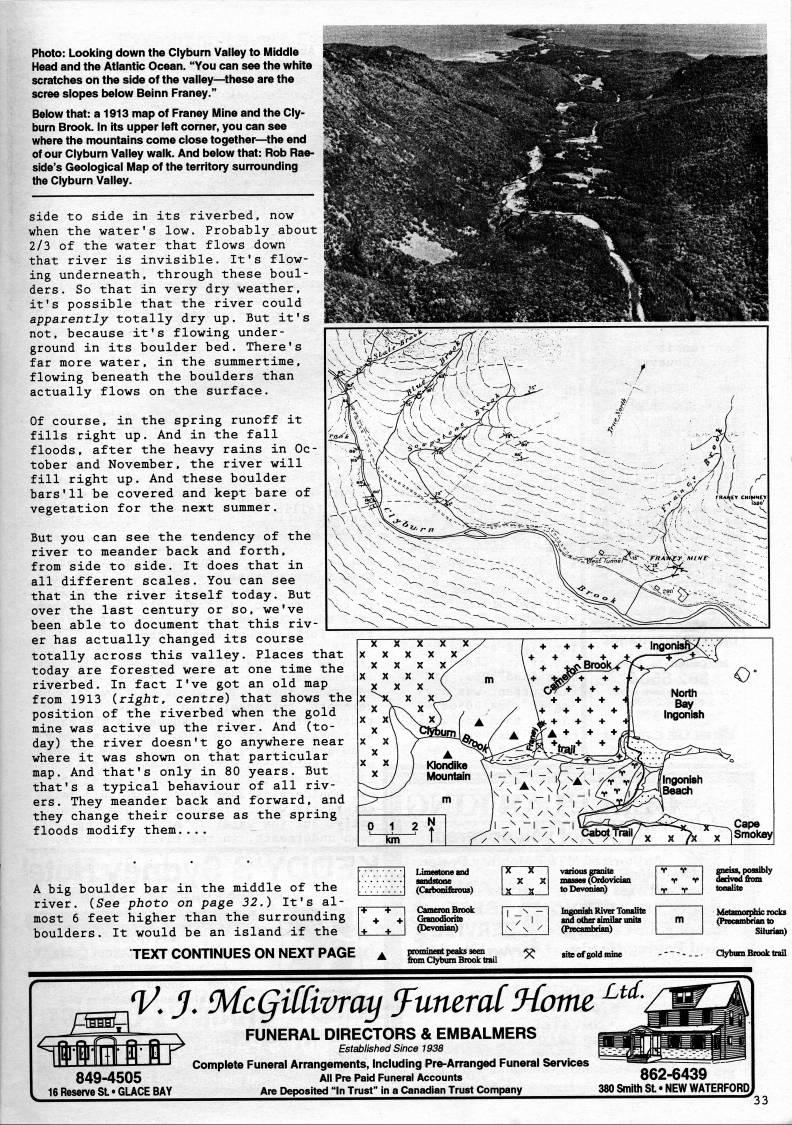
Photo: Looking down the Clyburn Valley to Middle Head and the Atlantic Ocean. "You can see the white scratches on the side of the valley • 'these are the scree slopes iselow Beinn Franey." Below that: a 1913 map of Franey IMine and the Cly? burn Brook. In its upper left corner, you can see where the mountains come close together • the end of our Clyburn Valley walk. And below that: Rob Rae- side's Geological fAap ot the territory surrounding tlie Clyburn Valley. side to side in its riverbed, now when the water's low. Probably about 2/3 of the water that flows down that river is invisible. It's flow? ing underneath, through these boul? ders. So that in very dry weather, it's possible that the river could apparently totally dry up. But it's not, because it's flowing under? ground in its boulder bed. There's far more water, in the summertime, flowing beneath the boulders than actually flows on the surface. Of course, in the spring runoff it fills right up. And in the fall floods, after the heavy rains in Oc? tober and November, the river will fill right up. And these boulder bars'11 be covered and kept bare of vegetation for the next summer. But you can see the tendency of the river to meander back and forth, from side to side. It does that in all different scales. You can see that in the river itself today. But over the last century or so, we've been able to document that this riv? er has actually changed its course totally across this valley. Places that today are forested were at one time the riverbed. In fact I've got an old map from 1913 (right, centre) that shows the position of the riverbed when the gold mine was active up the river. And (to? day) the river doesn't go anywhere near where it was shown on that particular map. And that's only in 80 years. But that's a typical behaviour of all riv? ers. They meander back and forward, and they change their course as the spring floods modify them.... A big boulder bar in the middle of the river. (See photo on page 32.) It's al? most 6 feet higher than the surrounding boulders. It would be an island if the TEXT CONTINUES ON NEXT PAGE 849-4505 16 ResenfeSL* GLACE BAY V. J. McQitCivray ffumrcd!Ho7m FUNERAL DIRECTORS & EMBALMERS Estabiistied Since 1938 Complete Funeral Arrangements, Including Pre-Arranged Funeral Services AM Pre Paid Funeral Accounts Are Deposited "In Trust" in a Canadian Trust Company Ltd. 862-6439 380 Smith SL • NEW WATERFORD


Adobe Acrobat Reader is required to the PDF version of this content. Click here to download and install the Acrobat plugin